
Great Southern WALK
COALCLIFF RE-Route
Brief
This project aims to investigate and scope an alternate alignment for the Great Southern Walk to bypass Lot 58 DP1097339 (Illawarra Coke Company land). The new route will be developed in line with sustainable trail design principles and best-practice methodology, aiming to meet AS2156 Grade 3–4 walking trail standards. The alignment will be guided by detailed terrain and hydrology analysis and refined through on-ground assessment.
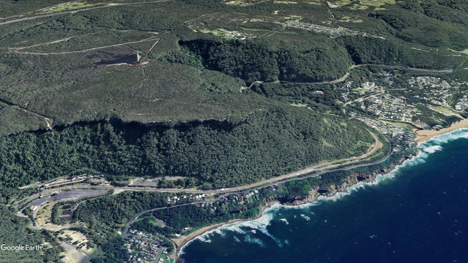
Location: Coalcliff, Illawarra Escarpment, NSW
Land Manager: NSW National Parks and Wildlife Service (South Coast Branch)
Trail Standard: NPWS Park Facility Manual: 5 - Tracks and related structures
Report By: Jack Rahilly, Advanced Trail Design
Prepared For: Alannah Dickeson, Project Officer,
NSW National Parks & Wildlife ServiceDate: 23/06/2025
Terrain ANALYSIS
The terrain was analysed using a high-resolution 1m LiDAR model and GIS software to identify optimal alignments for a walking trail. Key factors included vegetation cover, elevation, slope gradients, and watercourses.
Satellite imagery was used to identify tree cover, which supports sustainable trail environments by providing shade, stabilising soil, and suppressing grasses. It also highlights infrastructure and water bodies to be avoided or considered.
Coalcliff Dam Fire Road, a service-vehicle-only route, intersects the area and may be crossed or used briefly. The entire area is forested, meaning the trail will be protected by canopy wherever it is aligned.
Height mapping shows that the project area sits atop a plateau above the cliffs. Elevation ranges from 319m to 255m across a relatively flat area, suggesting the re-routed trail will have a gentle, accessible gradient.
Side slope mapping uses colour coding to indicate suitability for trail placement based on the “half rule” of sustainable trail design, which recommends that a trail’s gradient not exceed half of the side slope’s grade. Areas under 10% slope are generally avoided due to poor drainage, areas exceeding 40% become progressively more expensive to construct due to rocky terrain.
The project area ranges from 0–20% side slope. While the west side of Coalcliff Dam Fire Road offers moderate slopes more suitable for drainage, the east is flatter and more prone to waterlogging, similar to much of the existing Great Southern Walk. This unavoidable condition will require careful planning for drainage and surfacing.
Vegetation mapping was sourced from the NSW Government’s SEED portal. The Southeast NSW Native Vegetation layer identified the predominant vegetation type within the project area as Coastal Sandstone Ridgetop Woodland, with some isolated patches of Coastal Upland Swamp. No areas classified as Biodiversity Values in the project area.
LiDAR DEM Source: NSW Government DCS Spatial Services, Wollongong dataset.
Date: 2021
Resolution: 1m
Highest point: 319m
Lowest point: 255m
Elevation Difference: 64m
Side Slope: 0-20%
Vegetation Type:
Coastal Sandstone Ridgetop Woodland
Coastal Upland Swamp
Watershed ANALYSIS
A watershed analysis was conducted to identify local watercourses, estimate catchment areas, and determine potential surface flow rates within the study area. This data informed trail alignment and infrastructure planning.
Using the 1 m resolution LiDAR-derived digital elevation model (DEM), watercourses and catchment boundaries were delineated in GIS. Rainfall data was sourced from the Helensburgh weather station (WS0049) via the Australian Bureau of Meteorology’s Water Data Online platform. The highest recorded hourly rainfall intensity was used as a conservative design parameter—30 mm/hr, based on the wettest day on record and the hour with the most intense rainfall.
To estimate surface runoff, a runoff coefficient was derived by comparing annual rainfall and runoff totals using data from the Bureau of Meteorology’s Australian Water Outlook. For the selected year, total precipitation was 1439 mm and runoff was 567 mm, resulting in a runoff coefficient of 0.394.
Two primary watersheds were identified within the project area. Where possible, watercourse crossings were avoided to minimise environmental impact and infrastructure costs. Where crossings are necessary, the following estimates provide a basis for preliminary sizing of culverts or bridges.
LiDAR DEM: 1m resolution
Rain Station: Helensburgh WS0049 (BOM)
Runoff Data: Bureau of Meteorology, Australian Water Outlook
Max Probable Rain Intensity: 30mm/hr
Runoff Coefficient: 0.394
Watershed 1:
Area: 254 450 m²
Estimated Flow Rate: 0.835 m³/s (835 L/s)
Crossing Requirement: 525 mm diameter culvert, or a bridge with equivalent hydraulic capacity
Watershed 2
Area: 116 150 m²
Estimated Flow Rate: 0.381 m³/s (381 L/s)
Crossing Requirement: 375 mm diameter culvert, or a bridge with equivalent hydraulic capacity
Note: This analysis serves as a preliminary guide for sustainable trail placement. It's based on estimated rainfall and runoff data, which may not account for long-term cycles or climate change. Further research and risk assessment is needed for infrastructure design where safety is critical.
Ground Truthing
Following the desktop investigation of terrain and watershed patterns, the next stage of the trail design involved on-site validation. A preliminary alignment had been plotted by Advanced Trail Design to bypass the Illawarra Coke Company land while maintaining an average gradient of approximately 5%, ensuring accessibility and minimising environmental impact.
Objectives:
Follow the GPS path created in the desktop design.
Confirm that the alignment meets AS 2156.1 Class 3 walking trail standards and adjust as necessary.
Identify and avoid areas unsuitable for trail construction, such as waterlogged zones, ecologically sensitive sites, or dense scrub.
Confirm locations and estimate quantities for stair installations in line with AS 2156.2 Trail Infrastructure guidelines.
Identify suitable treatments for watercourse crossings.
This assessment was carried out during a one-day field visit by staff from Advanced Trail Design and the NSW National Parks and Wildlife Service (NPWS).
Findings
While walking the proposed alignment, several areas of dense banksia scrub were encountered. The trail was re-routed on-site to avoid these thickets, which likely correspond to Coastal Upland Swamp as shown in vegetation mapping. An existing informal trail connecting the Great Southern Walk to Coalcliff Dam was also identified. NPWS staff confirmed this trail is to be formalised to provide access to a new campsite. Integrating the new alignment with this existing route would reduce the need for new trail construction, thereby limiting environmental disturbance.
During the inspection of the Forest Walking Track along the clifftop above Stanwell Park (part of the existing Great Southern Walk), its scenic coastal views and recent infrastructure investment were evident. Given its value, a second alignment option was explored. This route departs from the north-west corner of the Illawarra Coke Company land, follows its northern boundary, and rejoins the Great Southern Walk at the eastern cliff line. While offering improved connectivity and views, this option would increase the trail footprint and require infrastructure to cross two major watercourses.
The vegetation throughout the site consisted mainly of Banksia and Eucalyptus woodland, with sandy soils, with roots and occasional bedrock. Although dry at the time of the visit, the flat terrain, grassy understory, and coastal climate suggest many sections would prone to waterlogging. Boardwalks are recommended for long-term durability in these areas.
Three key watercourse crossings were identified:
Across the drainage trench west of Coalcliff Dam Fire Trail.
Two crossings along the ‘Option 2’ trail alignment over the identified major watercourses.
Additionally, one flight of steps will be required on the Option 2 alignment to traverse a rock shelf.
Site Visit Overview:
Date: 11th June 2025
Present:
Jack Rahilly, Advanced Trail Design
Alannah Dickeson, NSW National Parkes and Wildlife Services
Narelle Naumcevski Sykes, NSW National Parkes and Wildlife Services
New trail entry
Areas of dense Banksia scrub
Informal ‘campground trail’.
Typical vegetation on the west side of Coalcliff Dam Fire Trail
Typical vegetation on the east side of Coalcliff Dam Fire Trail
‘Watershed 1’ watercourse crossing
DESIGN
The trail has been carefully designed to maintain a low gradient, enhancing the walking experience and aligning with AS 2156.1 Class 3 trail standards. A gentle gradient reduces environmental impact by minimising erosion, reducers the need for costly infrastructure such as steps, and lowers long-term maintenance requirements. The alignment travels seamlessly through picturesque native bushland while avoiding dense vegetation to reduce clearing.
Option 1 – Primary Alignment
This option minimises new construction by incorporating the existing informal trail to the campground, limiting new trail length to 887 m.
Rating: Class 3
Length: 887m
Width: 1m
Average Gradient: 4%
Maximum Gradient: 10%
Estimated Duration: 18 min each way
Vegetation Type: Banksia and Eucalyptus woodland
Soil Type: Sandy soils, with roots and occasional bedrock
Bridge: 1 of, 5m total length
Steps: 0
Trail Cost est: $31,000
Infrastructure Cost est: $3,700
Total est: $34,700
Yearly Maintenance est: $4,400
Option 2 – Extended Alignment to Stanwell Park Clifftop
This optional alignment retains use of the existing infrastructure and scenic clifftop section of the Great Southern Walk above Stanwell Park. However it adds distance and complexity, requiring stair installation and additional watercourse crossings.
Rating: Class 3
Length: 1430m
Width: 1m
Average Gradient: 4%
Maximum Gradient: 10% (40% at steps)
Estimated Duration: 29 min each way
Vegetation Type: Banksia and Eucalyptus woodland
Soil Type: Sandy soils, with roots and occasional bedrock
Bridge: 3 of, 29m total length
Steps: 10
Trail Cost est: $50,000
Infrastructure Cost est: $23,000
Total est: $73,000
Yearly Maintenance est: $7,200
COSTING GUIDE

GPS TRACE
MAP
Click each item for more details.
— Great Southern Walk, (current)
— Great Southern Walk (closed)
— Campground Trail
— Coal Cliff Re-Route
— Coal Cliff Re-Route (option 2)
— Watercourse Crossing
Trail Guidelines
As per NPWS Park Facility Manual: 5 - Tracks and related structures , it is advisable to adhere to the five sustainable trail construction principles outlined by the International Mountain Biking Association (IMBA). First published in 1993 these are considered the world-class standard for constructing natural surface trails, not just for mountain biking but for all trail use. The primary aim of these guidelines is to manage water flow on trails, thereby reducing erosion, maintaining trail quality, lowering maintenance costs, and protecting the surrounding environment.
The trail corridors, provided in GIS format, have been designed following these IMBA guidelines:
The Half Rule.
The 10% Average Gradient Rule.
Maximum Gradient Rule.
Construction Phase Implementation:
The following steps should be implemented during the construction phase to further enhance sustainability:
4. Grade Reversals.
5. Outslope.
Australian Standards Walking Track - Class 3 Guidelines
Full details refer to: NPWS Park Facility Manual: 5 - Tracks and related structures
Trail Corridor
Dimension required for safe passage and visibility.
Trail Tread: 1m
Trail Corridor: 1.5 - 2m
Trail Ceiling: 2.4m
Trail Bench
Full benching is the preferred method for achieving durability and consistency in the tread surface of the trail. In cases where partial benching is unavoidable, such as around tree roots or impenetrable rock, a retaining wall made from local rock should be used to reinforce the downside and prevent erosion.
References
Please help Advanced Trail Design by leaving a Google business review.
