
TuggerANONG BIKE PARK
A Tribute TO LOVE OF MOUNTAIN BIKING
1.1 BRIEF
This project brief outlines the design of a community-led mountain bike trail on the hill in Gordon, Tuggeranong, created as a tribute to a shared love of mountain biking. The vision is a trail where local riders of all ages can build skills, enjoy the outdoors and connect with the riding community, close to home.
This page will be updated as the project develops.
Location: Block 3 Section 475, Gordon ACT (off Drakeford Drive)
Area: 19.8 ha (likely allowed project area)
Land Manager: ACT Government (to be confirmed)
Guidelines:
Australian Mountain Bike Trail Guidelines
International Mountain Bicycling Association (IMBA) Sustainable Trail Design Principles
Design: Jack Rahilly, Advanced Trail Design
Trail Builder: Iconic Trails
1.2 Terrain ANALYSIS
The site terrain was evaluated using the ACT Government 2020 1m LiDAR digital elevation model (DEM) and GIS software to establish trail feasibility, natural drainage characteristics, and required earthworks. Key factors included vegetation cover, elevation, and slope gradients.
1.2.1 Satellite Imagery
Satellite imagery was used to identify tree cover, which supports sustainable trail environments by providing shade, stabilising soil and suppressing grasses. It also highlights infrastructure and water bodies that need to be avoided or accommodated.
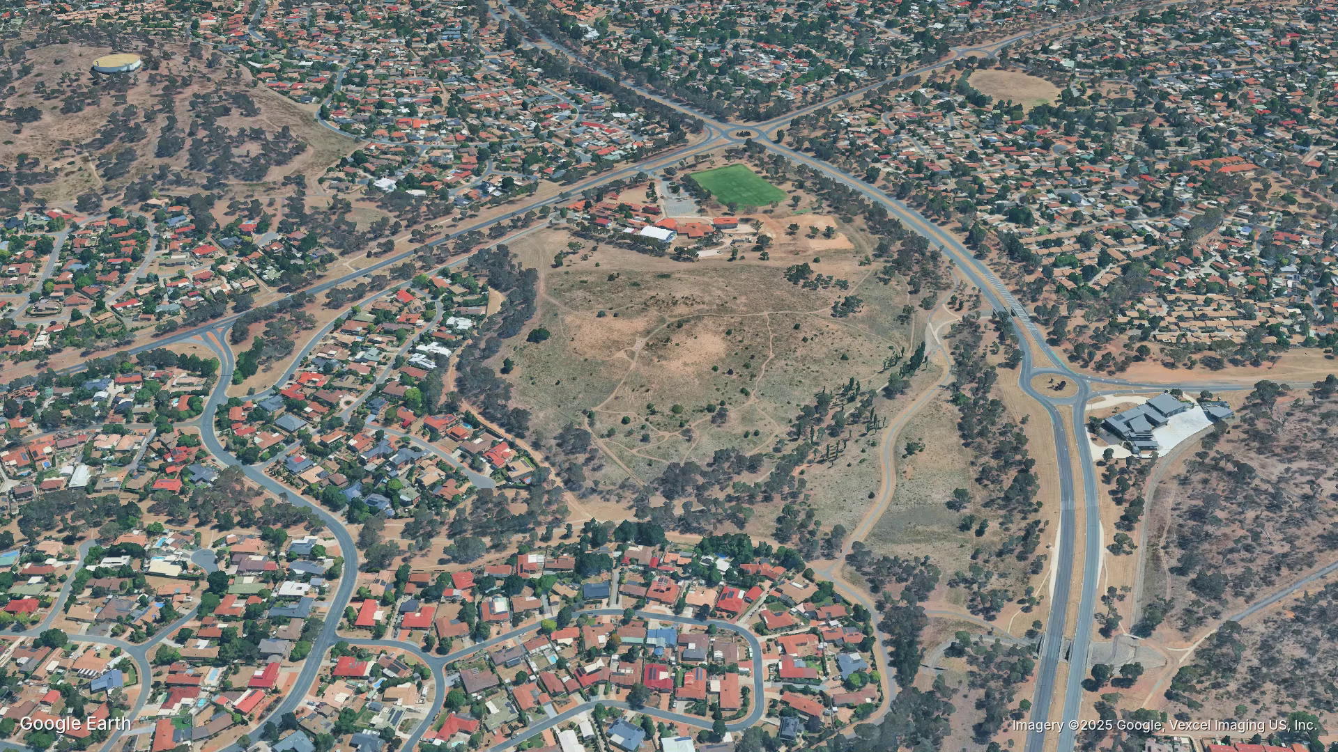
The main project area is predominantly open grassland, with scattered trees across the hill and denser tree belts along the western and southern edges. Tree planting is recommended as part of the trail works to reduce ongoing maintenance and to shelter riders from the summer sun and winter winds. New trees should be kept clear of rider fall zones, such as jump landings and the outside of corners.
The site is bordered by Covenant Christian School and Christ Church Tuggeranong to the north, Drakeford Drive to the east, and the residential streets of Gordon to the west and south. A concrete shared path runs along the eastern side, and trails should avoid crossing it.
1.2.2 Height mapping
Elevation mapping reveals a maximum high point of 628.2m at the hilltop near the centre of the site and a low point of 588.1m at the south-western corner, establishing a total vertical drop of 40m. With roughly 330m between the highest and lowest points, the natural surface gradient averages about 12%.
This fall suits a hilltop start, with descending flow trails radiating from the summit and climbing routes able to wrap around the hill at sustainable grades.
Potential Descents:
Easy (Green): 570m @ 7%
Intermediate (Blue): 400m @ 10%
Difficult (Black): 270m @ 15%
Potential Climb:
Easy (Green): ,330m @ 3%
Lengths are based on a single run using the full 40m of fall from the summit to the lowest point. Multiple descent lines can share the one climb, forming a looped trail network across the hill.
1.2.3 Side Slope Mapping
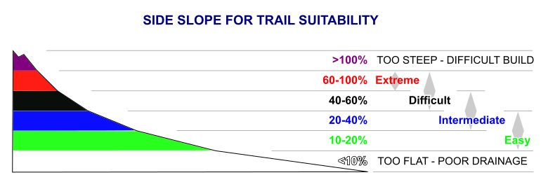
Side slope analysis evaluates site gradients against the "half-rule" of sustainable trail design, which dictates that a trail's grade should not exceed half the cross-slope grade to prevent water from scouring along the track. Areas under 10% slope are generally avoided due to poor drainage, areas exceeding 40% become progressively more expensive to construct due to rocky terrain, and above 60% can become geotechnically unstable.
Around 42% of the site sits in the 10–20% easy side-slope range, with a further 10% in the 20–40% intermediate range, mainly on the southern and western flanks of the hill. These slopes naturally support drainage and sustainable benched trail construction. Less than 1% of the site exceeds 40%.
The remaining 49%, including the broad hilltop and the gentler eastern and northern slopes, is under 10%. These areas should be avoided due to poor natural drainage, with the trails likely to become water logged.
Next Steps..
Terrain analysis confirms the site is well suited to mountain bike trails of generous length. Once approved, trail plotting can begin, shaping each alignment to draw the most flow from the available terrain.

References
Please help Advanced Trail Design by leaving a Google business review.
